![Item #3387 [WORLD MAP]. A New Chart of the World on Mercator's Projection with The Tracks &...](https://michaellaird.cdn.bibliopolis.com/pictures/3387.jpg?width=320&height=427&fit=bounds&auto=webp&v=1620845709)
[WORLD MAP]. A New Chart of the World on Mercator's Projection with The Tracks & Discoveries of the Latest Circumnavigators &c.
London: Laurie and Whittle. No. 53, Fleet Street, 1789 (or 1794?). Original copper-engraved map with contemporary hand-colored outline and rather hastily-applied wash which in some instances extends into the outer margins. Professionally matted (visible size: 420 x 320 mm; 16.5" x 12.5"), very handsome 20th-century wood frame. Original engraving, NOT..... More
![Item #3952 [WESTERN AMERICANA]. Report of the Exploring Expedition to the Rocky Mountains in the...](https://michaellaird.cdn.bibliopolis.com/pictures/3952.jpg?width=320&height=427&fit=bounds&auto=webp&v=1681219772)
![Item #3431 [AMERICA. Engraved map ca. 1600, North and South America with portion of Australia]....](https://michaellaird.cdn.bibliopolis.com/pictures/3431.jpg?width=320&height=427&fit=bounds&auto=webp&v=1615672014)
![Item #816 [TEXANA]. The Texas and Oklahoma Official Railway & Hotel Guide Map, WITH THE RARE...](https://michaellaird.cdn.bibliopolis.com/pictures/816.jpg?width=320&height=427&fit=bounds&auto=webp&v=1763316149)
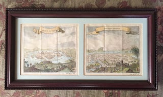
![Item #3877 [UKRAINE - Two Unrecorded Nazi Wehrmacht Field Printings of Kyiv]. "Blick v.d. Lissa...](https://michaellaird.cdn.bibliopolis.com/pictures/3877.jpg?width=320&height=427&fit=bounds&auto=webp&v=1666623798)
![Item #3560 [MAPPING THE WEST - COMPLETE SET IN PERFECT CONDITION]. Mapping the Transmississippi...](https://michaellaird.cdn.bibliopolis.com/pictures/3560.jpg?width=320&height=427&fit=bounds&auto=webp&v=1666570967)
![Item #3444 [HUGE MAP OF OREGON 1845]. Map of the Oregon Territory by the U.S. Ex. Ex. Charles...](https://michaellaird.cdn.bibliopolis.com/pictures/3444.jpg?width=320&height=427&fit=bounds&auto=webp&v=1616874895)