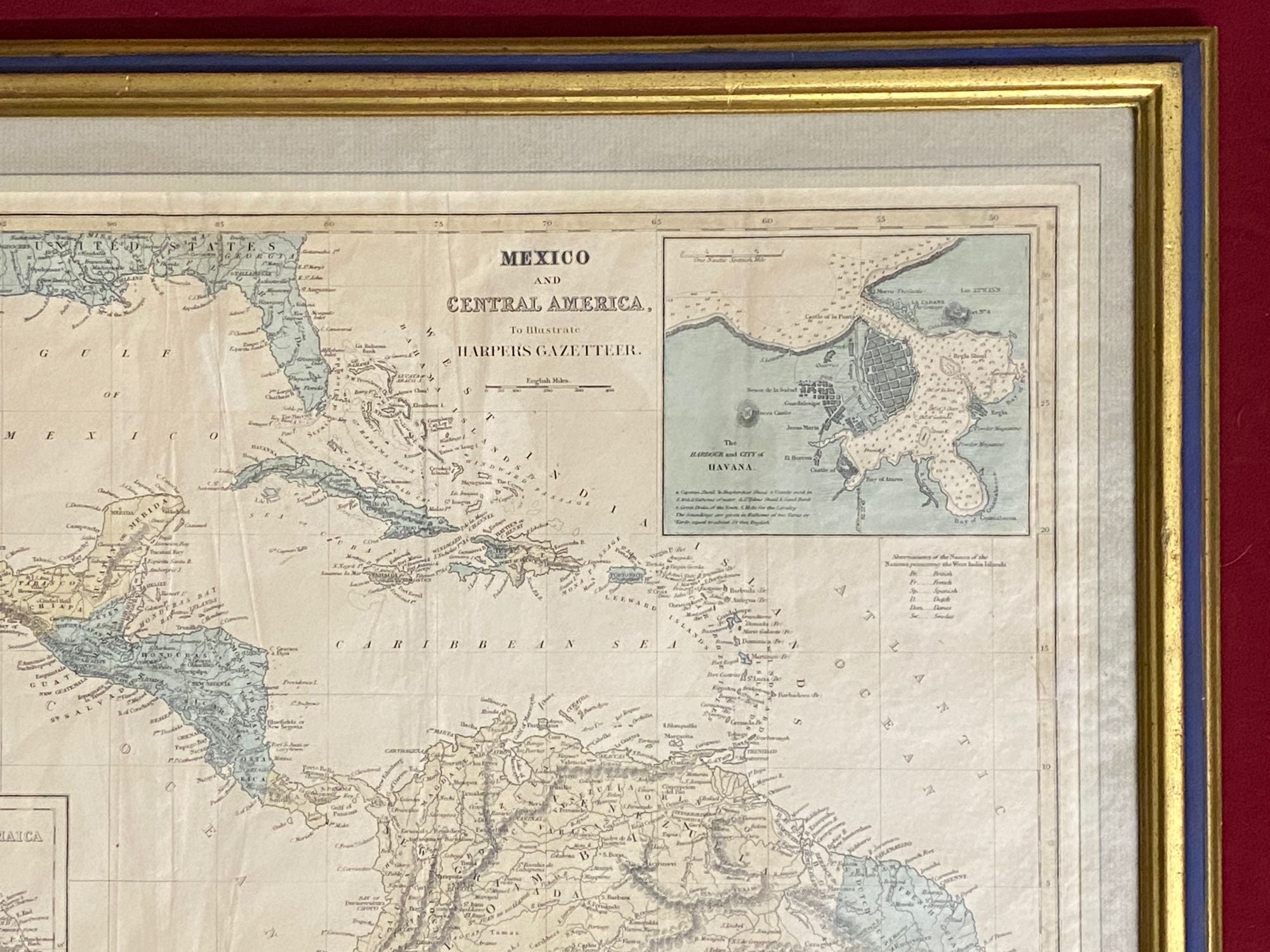

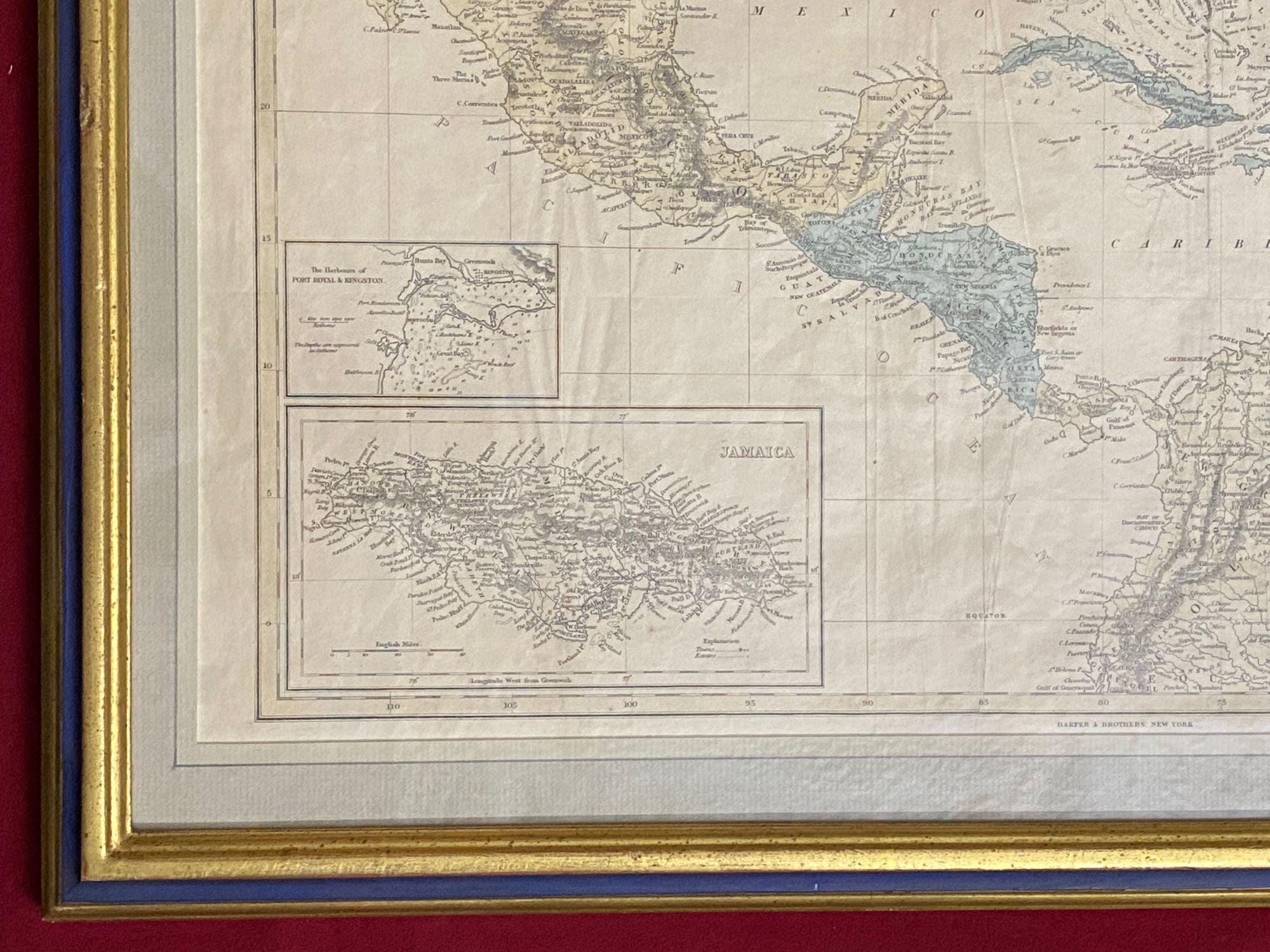
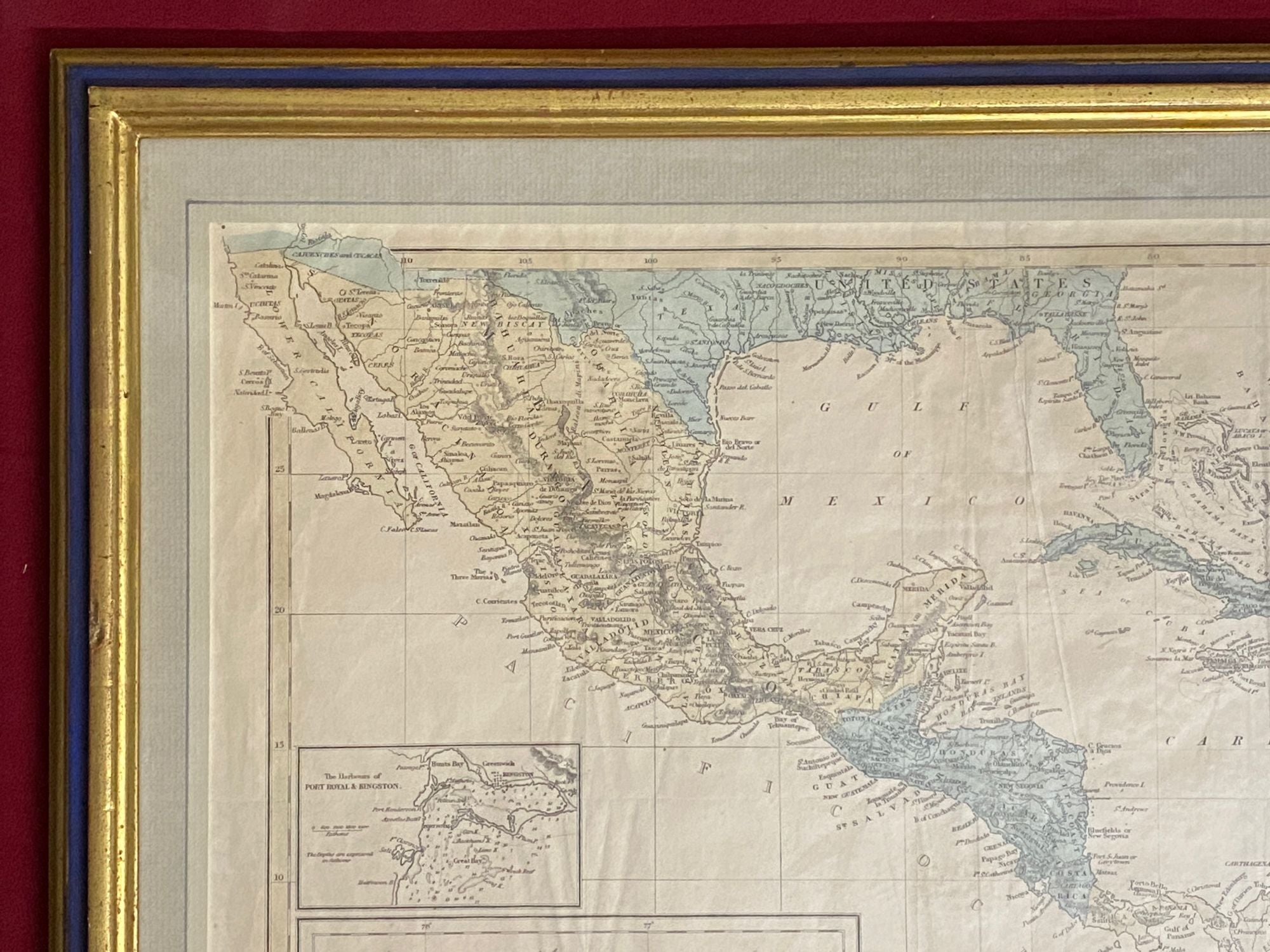
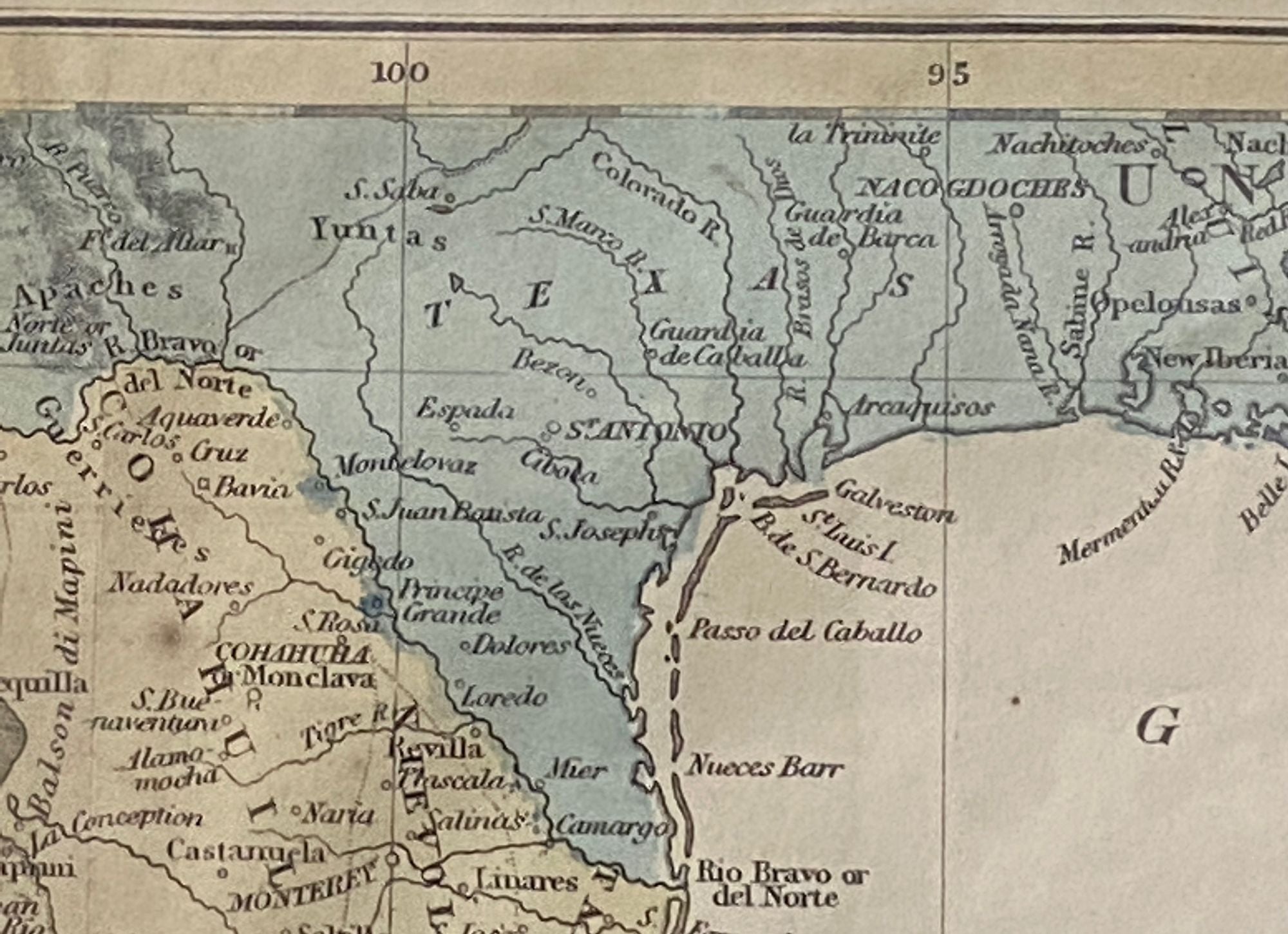

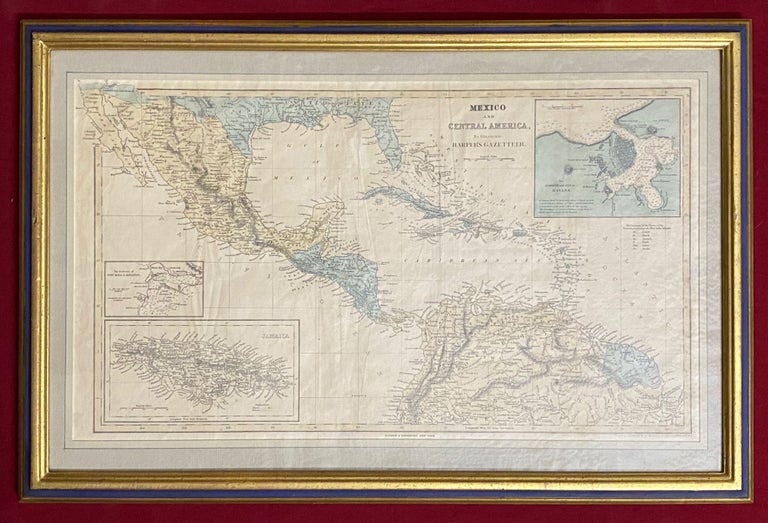
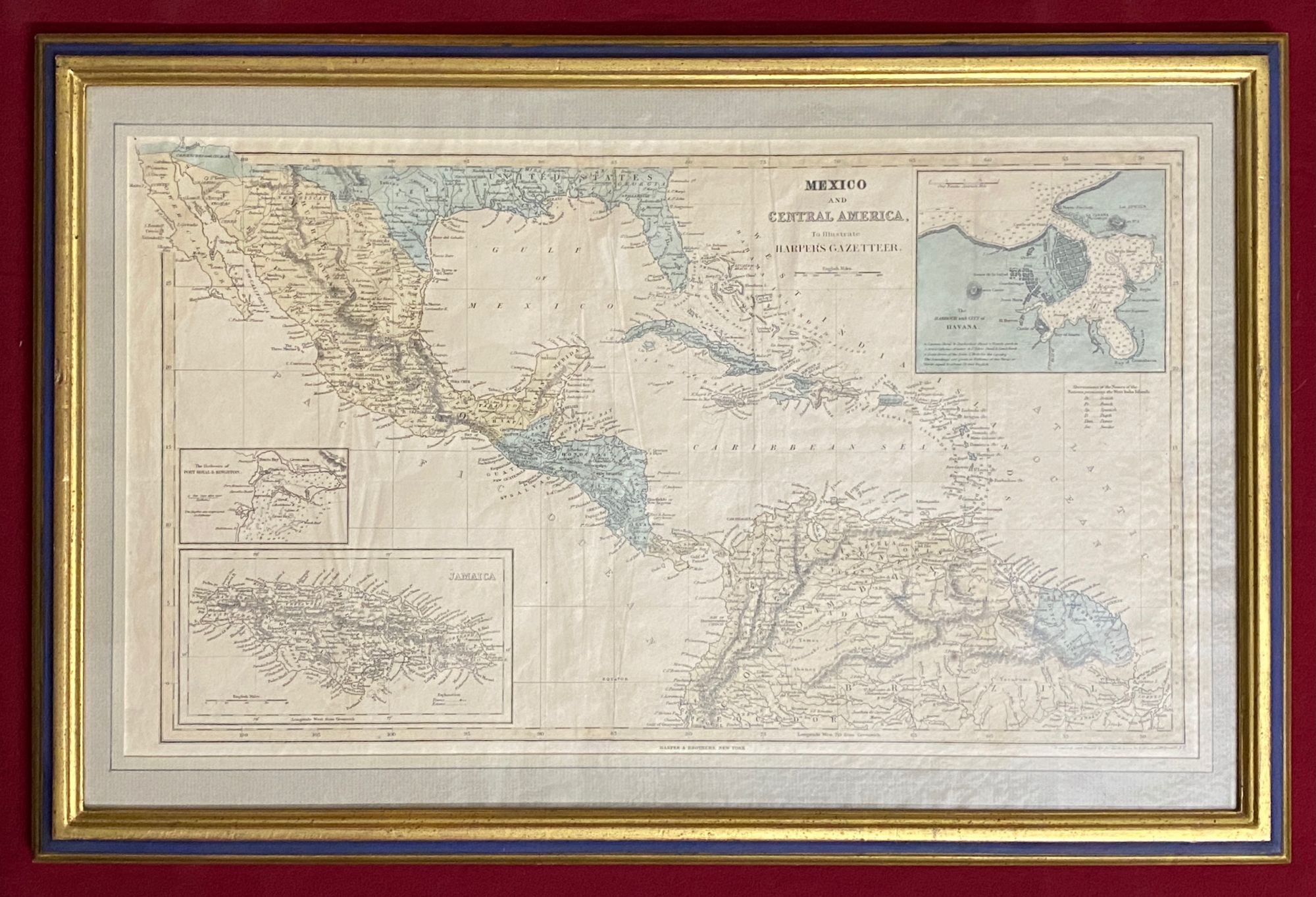
Mexico and Central America to illustrate Harper's Gazetteer
New York: Harper & Brothers, 1855. First Edition. Large framed map (30 x 50 cm). Contemporary hand-coloring with blue wash, creasing where formerly folded. Evidence of repaired tear on right margin affecting border but not the map itself (not examined outside frame). Scale ca. 1:13,000,000. Good. Item #3443
Scarce and important map, framed, and suitable for exhibition and study. The map shows sailing routes through the West Indies, major cities, and ports. Lower Mexico and northwest coast of South America is displayed and Texas is shown to be part of United States. Insets: "Jamaica," "The Harbours of Port Royal and Kingston," and "The Harbour and City of Havana." Includes key to "Abreviations of the Names of the Nations possessing the West India Is[lands]" and notes. This map formed part of Harper's Statistical Gazetteer of the World (1855).
Price: $250.00