![Item #2003 [VERNACULAR PHOTO ALBUM]. [WYOMING]. "Photographs on the Wind River Indian Reservation, Wyoming Showing Agricultural, Hydrologic, and Topographic Features. October 31 to November 1, 1980" David Keith Todd.](https://michaellaird.cdn.bibliopolis.com/pictures/2003.jpg?width=768&height=1000&fit=bounds&auto=webp&v=1553284421)
![[VERNACULAR PHOTO ALBUM]. [WYOMING]. "Photographs on the Wind River Indian Reservation, Wyoming Showing Agricultural, Hydrologic, and Topographic Features. October 31 to November 1, 1980"](https://michaellaird.cdn.bibliopolis.com/pictures/2003_2.jpg?auto=webp&v=1553284422)
![[VERNACULAR PHOTO ALBUM]. [WYOMING]. "Photographs on the Wind River Indian Reservation, Wyoming Showing Agricultural, Hydrologic, and Topographic Features. October 31 to November 1, 1980"](https://michaellaird.cdn.bibliopolis.com/pictures/2003_3.jpg?auto=webp&v=1553284422)
![[VERNACULAR PHOTO ALBUM]. [WYOMING]. "Photographs on the Wind River Indian Reservation, Wyoming Showing Agricultural, Hydrologic, and Topographic Features. October 31 to November 1, 1980"](https://michaellaird.cdn.bibliopolis.com/pictures/2003_4.jpg?auto=webp&v=1553284422)
![[VERNACULAR PHOTO ALBUM]. [WYOMING]. "Photographs on the Wind River Indian Reservation, Wyoming Showing Agricultural, Hydrologic, and Topographic Features. October 31 to November 1, 1980"](https://michaellaird.cdn.bibliopolis.com/pictures/2003_5.jpg?auto=webp&v=1553284422)
![[VERNACULAR PHOTO ALBUM]. [WYOMING]. "Photographs on the Wind River Indian Reservation, Wyoming Showing Agricultural, Hydrologic, and Topographic Features. October 31 to November 1, 1980"](https://michaellaird.cdn.bibliopolis.com/pictures/2003_6.jpg?auto=webp&v=1553284423)
![[VERNACULAR PHOTO ALBUM]. [WYOMING]. "Photographs on the Wind River Indian Reservation, Wyoming Showing Agricultural, Hydrologic, and Topographic Features. October 31 to November 1, 1980"](https://michaellaird.cdn.bibliopolis.com/pictures/2003_7.jpg?auto=webp&v=1553284423)
![[VERNACULAR PHOTO ALBUM]. [WYOMING]. "Photographs on the Wind River Indian Reservation, Wyoming Showing Agricultural, Hydrologic, and Topographic Features. October 31 to November 1, 1980"](https://michaellaird.cdn.bibliopolis.com/pictures/2003_8.jpg?auto=webp&v=1553284423)
![[VERNACULAR PHOTO ALBUM]. [WYOMING]. "Photographs on the Wind River Indian Reservation, Wyoming Showing Agricultural, Hydrologic, and Topographic Features. October 31 to November 1, 1980"](https://michaellaird.cdn.bibliopolis.com/pictures/2003_10.jpg?auto=webp&v=1553284421)
[VERNACULAR PHOTO ALBUM]. [WYOMING]. "Photographs on the Wind River Indian Reservation, Wyoming Showing Agricultural, Hydrologic, and Topographic Features. October 31 to November 1, 1980"
Wyoming. First Edition. Hardcover. Tall narrow photo album containing 52 color photographs (all 3.5" x 5") inserted into an assemblage of 60 sleeves (numbered 2-61), all with typed captions (and thus 8 photos are no longer present), ca. 50% of the photos are aerial views. Very good. Item #2003
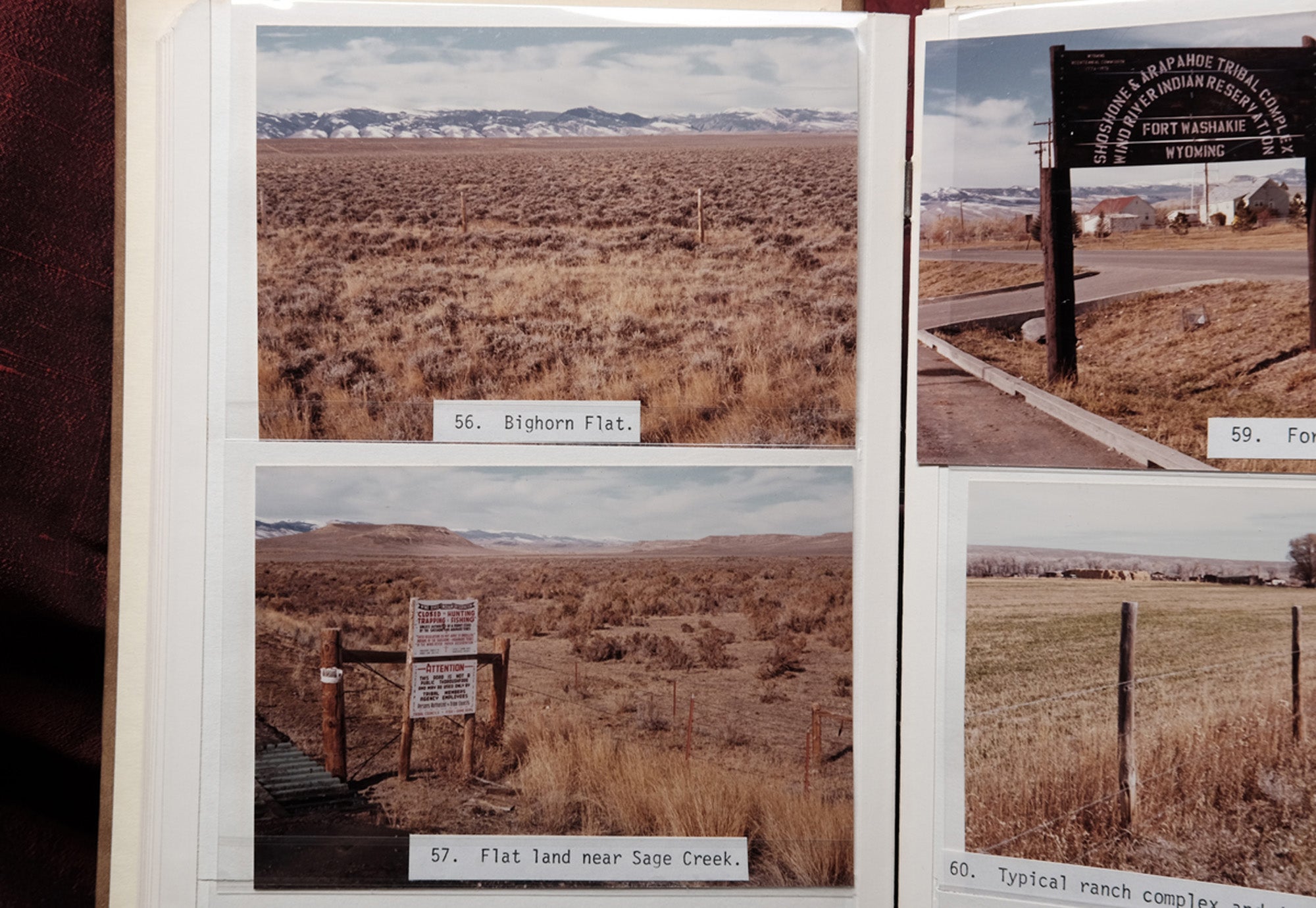
Curious 1980 photo album showing landscapes and topography of the Wind River Indian Reservation and environs, many being aerial views. Well documented are the rivers that run through and around the Reservation (Wind River, Little Wind River, Pope Agie River), the flatlands (Bighorn Flat), lakes (Bull Lake and Dam, Ocean Lake), creeks (Willow, Owl and Crow Creeks), irrigation canals, mountains, empty reservoir behind Anchor Dam, Arapahoe Ranch, Fort Washakie, and more. These photographs were taken by David Keith Todd (1923-2006), a renowned hydrologist. The album's original intent seems to have been as a record of potential water resources and possible development on the reservation, but the results are striking, portraying vast areas of austere landscapes. The photographer was a UC Berkeley Prof. Emeritus of Civil and Environmental Engineering and a leader among modern groundwater engineers. He was renowned hydrologist specialized in the extraction of groundwater for beneficial purposes and efficient management. Although Todd’s bibliography extends to more than 115 articles and monographs, the photographs in the present album (dated 1980) may not have been utilized as illustrations. Photo No. 47 shows Todd standing near "irrigated land" that nonetheless looks decidedly parched; it is unclear why he is smiling at the camera.
Price: $300.00